Update: Downeast Day 1
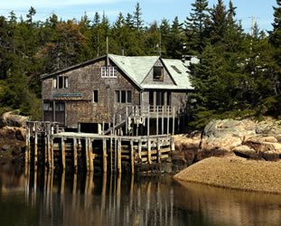
The meaning comes from sailing downwind from Boston which is actually north east. The people of the area even have their own lexicon. Check it out at Downeast/Maritime Lexicon. Our trip took us along the coast on Highway 1, up the St. Croix River, across to New Brunswick at Calais/St. Stephen, down to St. Andrews, and back to Acadia National Park across Highway 9. Our first stop was near Winter Harbor for a nice view of the harbor and a geocache called PePe LePew with a View. We enjoyed the cache title related to the cartoon character and quickly figured out the reference. You'll have to go to the cache for the secret. |
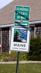
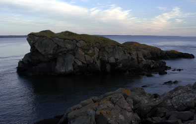
Schoodic Unit of Acadia National Park Although we enjoy National Parks, we hate the crowds so we were excited to find that the Schoodic Unit of Acadia National Park was relatively nice and quiet. We drove the Schoodic Scenic Byway from Ellsworth to Schoodic. We stopped along the road and enjoyed the view of Cadillac Mountain on Mount Desert Island while exploring the tide pools.
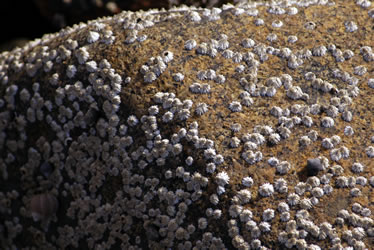
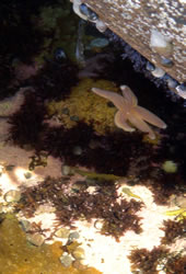
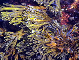
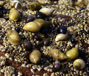
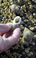
We found mussels, barnacles (below left), starfish (below right), periwinkle (bottom row), whelks, sea urchins, moss, rockweed (middle row), and many other sea creatures and plantlife.
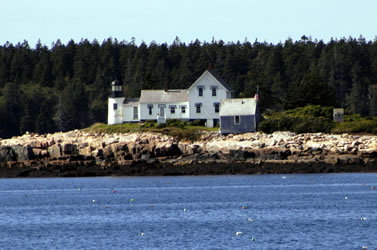
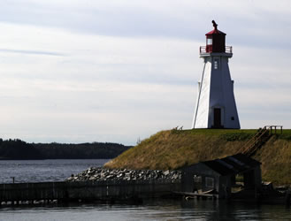
We drove up the road and made another stop across from Mount Desert Island. We could see Winter Harbor Lighthouse on Mark Island with Cadillac Mountain in the background.
At Schoodic Point, we watched sea birds and explored the rocks. Dark bands of rock are a sharp contrast to the pink granite. The dark bands are called "black dikes" and were formed when magma filled cracks in the rock.
They bring the boat close to the buoy, pull up the traps, open and gauge and place the lobster in a holding box, toss the junk, scrap and other sealife overboard, rebait the trap, and drop it back into the water. A flock of birds follow the boat hoping to get some of the bait remnants and other bits that are being thrown back into the water.
At the Schoodic Point, the people from LLBean were doing a photo shoot for an upcoming catalog. The park ranger said that they had to get permission to do the photo shoot. Can you identify the models in the photo; clue, there were three.
|
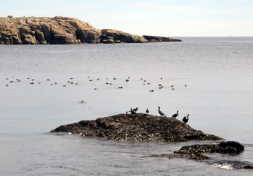
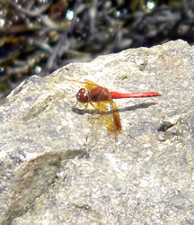
Near the end of our Schoodic Unit drive we stopped to photograph birds including cormorant and ducks. We also saw lots of different kinds of dragonflies The one below is a red skimmer.
|
 |
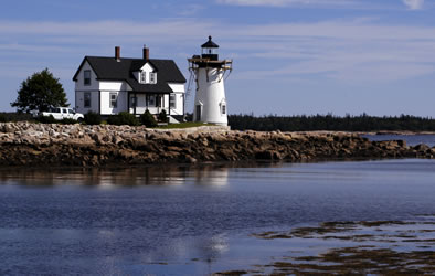
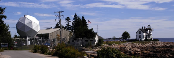
Prospect Harbor Lighthouse A few miles down the road, we stopped to photograph the Prospect Harbor Point Light. It was in the process of being renovated.
We couldn't get close because the lighthouse is on a Navy installation called the Naval Satellite Operations Center. Instead we walked along the beach and enjoyed the tide pools there.
|
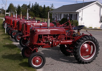
Coastal Drive We enjoyed our drive up the coast. It was a beautiful fall day, and we kept a leisurely schedule. Highway 1 winds through several small towns along the coast, and through farm and forest areas. Several farm areas were devoted to blueberries and cranberries. When we saw these tractors lined up on the side of the road, we immediately stopped to take photos for Annette's dad - - a Farmall tractor lover. There were about ten tractors and everyone was a different model.
|
Roosevelt Campobello International Park The Roosevelt Campobello International Park was established in 1964 as a joint park of the US and Canada. To reach the park, visitors can take the bridge from Maine or the ferry from Deer Island, New Brunswick to Campobello Island, New Brunswick. We took the bridge. The border crossing was quiet and easy.
After a brief stop to photograph Mulholland Lighthouse, we stopped at the New Brunswick welcome center where they provided a map and directions. The Roosevelt Campobello International Park Visitor Center is in a great location near the Roosevelt Cottage. The center has a nice exhibit and movie that provide an overview of the history and park. After watching the film we walked to the cottage.
|
|
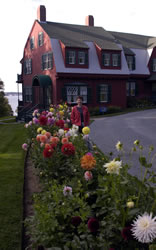
Roosevelt Cottage The FDR Summer Home was built in 1897. Sara Roosevelt purchased the home in 1909 and left it to her son, FDR. Franklin, Eleanor, and their family spent summers at the cottage from 1909 to 1921. In those days the cottage didn't have electricity, but it did have running water. We really enjoyed the knowledgeable, guided tour of the cottage. Rather than a group tour, interpretive guides are available throughout the building to provide an overview of the area of the house, answer questions, and direct you to your next stop.
From the interpretive guides to the quality artifacts, this was an excellent historical site. It was also exciting to see the cooperation between the US and Canada in establishing the park. |
Campobello Drive After visiting the Roosevelt cottage, we decide to explore the island with three goals in mind. First, we drove through Welchpool to the ferry landing. Since the ferry was closed for the season we decided not to go to Deer Island. Near the ferry landing was the Campobello Island Car Ferry Cache geocache along the beach.
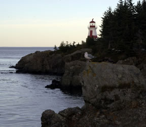
Second, we took a trip to the far end of the island to view the East Quoddy Lighthouse. It's one of the most famous lighthouses in New Brunswick. At low tide, you can climb down stairs to the beach, walk across the beach, and climb up stairs to get to the lighthouse. Since we arrived at high tide water covered the beach, so we had to take photographs from a distance. Third, as dusk approached we headed back to the Roosevelt Campobello International park to explore the natural area. We arrived at Liberty Point at dusk. We could see the West Quoddy Lighthouse across the water to the south. The area was thick with mosquitoes, so Annette stayed in the car and sketched the lighthouse. Larry braved the mosquitoes and photographed Sugar Loaf Rock and the Lighthouse.
|
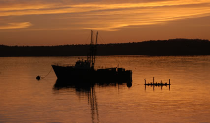
Eastpoint After crossing back over the Canadian-US border, we drove on northwest to Eastpoint to spend the night. By the way, Eastpoint claims to be the easternmost town in the US, but smaller-sized Lubec actually claims that title. We stayed at one of the few motels in the area, the Motel East. Although it overlooked the water, we arrived late and left early so we didn't spend much time enjoying the view. The front desk clerk at the motel recommended the Eastpoint Chowder House. It was a great choice. Larry had broiled halibut with gumbo and Annette had crusted haddock. We usually don't do desserts, but this excellent meal ended with our sharing a HUGE 4-layer piece of carrot cake. Yummy! The next morning Annette got up early to photograph the sunrise. This view over the water was taken from the doorway of our room.
|
Go to Lamb & Johnson Menu
|
 With only a few weeks left in our visit to Maine, we decided to take a couple of days and head "downeast." It may seem strange, but "downeast" is the area of Maine northeast of Acadia National Park and the Bar Harbor area along the coast into Canada including New Brunswick and Nova Scotia.
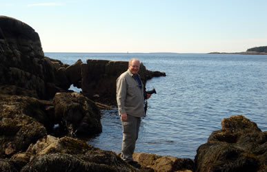
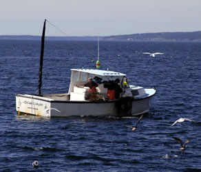 We could see a variety of boats in the distance including sail boats and fishing boats. It was interesting to watch the lobster boats. We learned that each fishing company has a color-coded buoy that is used to mark their lobster traps.
 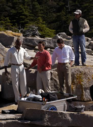 While in the area, we watched two boats. It was interesting that one group was much more organized and efficient than the other. We wondered whether the faster group was being paid by the pound.
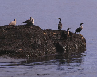
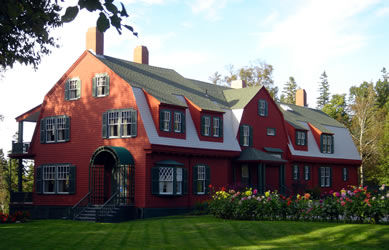
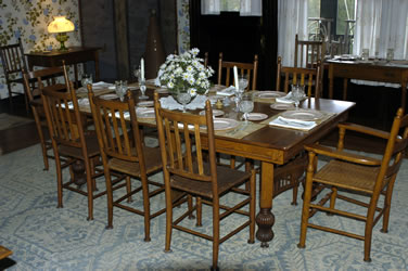
 Much of the house contains original furnishings and artifacts from the Roosevelts. Outside, we walked down the path to the landing where the Roosevelts would arrive from Eastpoint by boat.
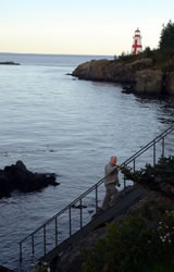