Update:
March 2004
|
We discovered a back road south of Hurricane, Utah. This led us southeast of St. George onto BLM land to an area where dinosaur tracks have been found in the Moenave Formation rock. At the time the tracks were made, the land was probably low and near a shallow lake. Today, the area is in a sandstone wash. The tracks of two different dinosaurs from the Jurassic period have been found. The large tracks were made by a prosauropod. This herbivore is an early duckbill dinosaur. A coelurosaur made the small tracks. They are carnivores and raptors.
|
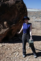
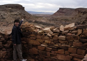
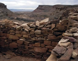
Just a few miles to the southwest, Fort Pearce was built in 1866 during the Black Hawk War. Although no battles were fought here, the war included a series of battles among the Ute Indians, Navajo raiders, and the Mormon settlers. The walls of the fort were originally 8 feet high. A person in the fort could see for many miles in every direction. The remains of the historic Fort Pearce can be found on a small hill. The BLM personnel are working on a new parking lot and hiking trail. They are also working on rebuilding some of the ruins.
We followed a short trail down the hill to the wash. Along the cliff wall, we found a series of petroglyphs on the rock. We also found the names of early pioneers painted on the rock (Photo right). On the way back into town we moved through an area where the winds often blow the sand across the road (Photo below). A road grader is frequently needed to keep the road open. We were glad we had our high-clearance vehicle.
|
We found another back road south of Hurricane for our next adventure. Again, we headed southeast of St. George on gravel, dirt, and sand roads. Little Black Mountain is a 500 foot mesa that stands alone in a huge area of old pastures and scrublands including creosote bushes. The top of the mountain is Chinle formation and the lower slopes are Moenkopi formation. Large boulders and rocks have fallen to the base of the mountains. Many of the rocks are covered with lichens. Birds, lizards, and small animals were found throughout the area.
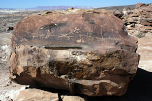
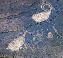
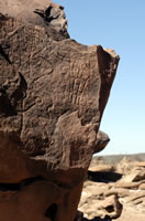
Here, we could see that BLM workers or volunteers were working on building a new shelter house. The Little Black Mountain site contains over 500 rock art designs on boulders scattered around the base of the south side of mountain. The designs include sheep, lizards, bear paws, turtles, people, and geometric designs. This rock art has been associated with the Great Basin, Western Anasazi, and Lower Colorado River cultures and may have social and religious meanings.
Using a brochure from the BLM office, we explored the three main petroglyph sites here. We also explored the unimproved area and located a geocache hidden there (Photo - above right).
|
Go to Lamb & Johnson
Menu
|
 In
late February and early March, we took a couple of short half-day trips.
The area around St. George, Utah is known as Dixie. Just south of the
city is the Arizona/Utah state line. The area between the state border
and the Grand Canyon is known as the Arizona Strip. In the picture,
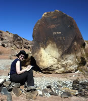
Annette is at Fort Pearce on Bureau of Land Management (BLM) land.
In
late February and early March, we took a couple of short half-day trips.
The area around St. George, Utah is known as Dixie. Just south of the
city is the Arizona/Utah state line. The area between the state border
and the Grand Canyon is known as the Arizona Strip. In the picture,
Annette is at Fort Pearce on Bureau of Land Management (BLM) land. 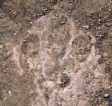 Dinosaur
Tracks
Dinosaur
Tracks 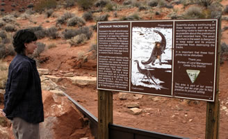
 Fort Pearce
 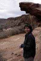 Petroglyphs
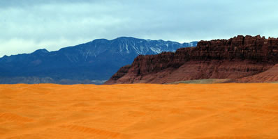
 Little Black
Mountain Petroglyph Site
Little Black
Mountain Petroglyph Site