Escalante: Hole-in-the Rock Road
We were disappointed in the campgrounds in the Escalante area. An investor could do really well with a high-end RV park. The Broken Bow Campground (Currently for sale) is an older, in-town park with short spaces, but it worked fine for our needs. |
"When one of us says 'look, there is nothing out there,' what we are really saying is, 'I cannot see'." |
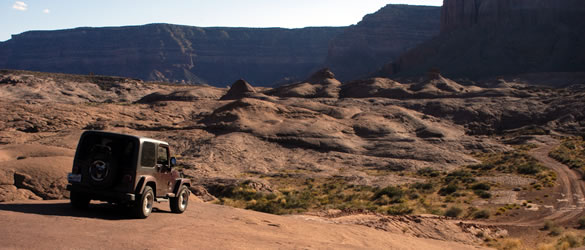
We decided to take two days to explore the Grand Staircase Escalante National Monument. Our first day included a drive down Hole-in-Rock road. The road follows the historic route of Mormon settlers in 1879-80 on their journey to cross the Colorado River. Today the gravel road is wide and well maintained.
|
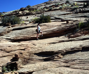
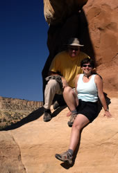
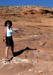
Our first stop was an area known as Devil's Garden. Like other places with a similar name, the area was filled with unique rock formations. The weather was clear and cool. Perfect for exploring.
|
We could hear bees buzzing and birds singing everywhere we walked. It was a peaceful place, perfect for sketching. We could have spent all day just enjoying the clear blue sky and the brown, orange, red formations. There are so few places left in the world where you can enjoy a perfectly clear sky without haze and pollution.
|
|
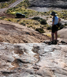
Most people seemed to walk to the end of the rocks, then turn around and leave. They were missing the fun of climbing and exploring! Annette particularly enjoyed sketching the interesting rock formations from the shade of a hoodoo. |
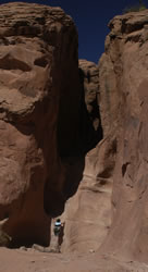
Slot Canyons Another highlight of our trip was the slot canyon area. We'd read about these narrow canyons in our books and on the Internet, but no one provided very good maps or directions. At mile marker 26.5, we turned off left to follow a rough, dirt road to the Dry Fork Wash Trailhead. |
|
The hike down into the canyon was easy and beautiful, but we quickly realized that we'd need to conserve water for the hike back up the steep canyon trail. We took three bottles of water and should have taken four - - more needed in hot weather. We saw many lizards as we made our way across the slick rocks and down the runoff areas to the canyon floor.
|
The Narrows When we reached the canyon floor, we followed the trail into a narrow slot canyon and quickly realized that this wasn't "Peek-a-boo Gulch." It was interesting, but not much of a challenge. We met a couple who provided good directions to both "Peek-a-boo" and "Spooky." We should have turned to the right and headed down the canyon rather than following the trail.
|
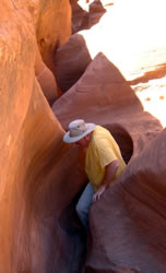
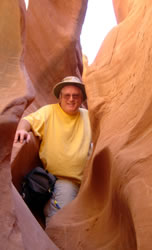
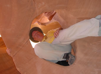
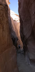
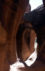
After backtracking to the main canyon, we quickly found the entrance to Peek-a-boo Gulch. It's easy to recognize, because there's a 15-foot high climb into the entrance. Annette complained that her short legs made the climb difficult. There were a couple places where Larry had to give her a boost. Once inside, we had a blast! There were arches, tunnels, and narrow slots. In most places you could see a thin line of bright blue sky above.
|
We were awed by the heart-shaded arch near the entrance. It was amazing how a slight movement of the camera changed the lighting and perspective.
|
|
| After some crawling, we emerged into a series of narrow curves that opened into the sunlight. This was a place where Annette's smaller body and short legs came in handy. While Larry struggled to get his body and bulky camera fanny pack around the corners, Annette got ahead and had fun laughing and taking the photos below. |
  |
 |
When we reached the end of Peek-A-Boo, we turned around and headed back to the entrance. After a hike through a wash and along a sandy trail, we found Spooky.
|
Spooky We were a little disappointed in Spooky. This is really just a very narrow slot canyon. It lacks the fun of Peek-A-Boo's arches and tunnels. The slot quickly became too narrow for Larry, so Annette went on for a while on her own. She had to take off her fanny pack, but had no trouble getting through. However after a while the tight squeeze lost it's appeal, so she also turned back and returned to the entrance. The slot canyons were dry, but we realized that several locations contained potholes that could fill with water. A few would be deep enough and could remain long after the danger of flash-flooding was over. |
|
 For some reason, the hike back up the canyon wasn't as fun as the hike down. After the strenuous climb back up and across sandy washes and the steep slick rock trails, we were happy to get back to the canyon rim, the Jeep, and cool drinks from the cooler. For some reason, the hike back up the canyon wasn't as fun as the hike down. After the strenuous climb back up and across sandy washes and the steep slick rock trails, we were happy to get back to the canyon rim, the Jeep, and cool drinks from the cooler. |
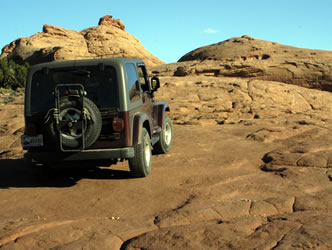
Time to get back onto the main road and head on towards Hole-in-the-Rock. Our guidebook said the road got very bad the last five miles, but we figured we could make it at least part of the way.
We came within two miles of the end of the road (today at Lake Powell) but finally decided to turn back. Part of the way up a steep slickrock section, we encountered an abrupt ledge about two-feet high. Scattered around the area were a few broken auto body trim and pieces. Further evidence of difficulty navigating the narrow ridge was seen in the numerous tire burn marks on the steep slickrock surfaces. Even though some small rocks had been gathered and stacked to help navigate the incline, we decided that this was the place to turn back or go on afoot. It was getting late, so we decided not to hike the last few miles other than climbing to the top of the next ridge. We might try the road again some time in the future, but this place requires extensive off-road experience and companion off-road travelers. If you break down out here the cell phones will not work; it's a long way back to find help. |
|
 |
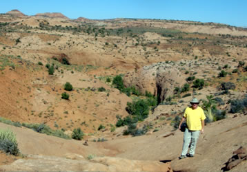
Besides our all-day trip while staying in Escalante, we also made a few shorter drives. One day we drove north toward Hell's Backbone to an area known as "The Box". We took a short hike up a steep canyon along a dry creek bed. |
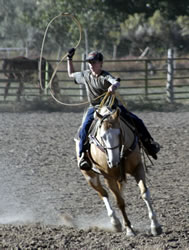
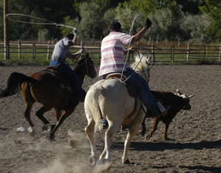
| On the way back into town, we stopped to visit and photograph a group of high-school students practicing calf team-roping for an upcoming competition. We also found the marker for an old CCC camp on the eastern outskirts of Escalante. It looked like the area was being developed for housing. We wondered what would happen to the CCC marker. |
  |
Go to Lamb & Johnson Menu
|
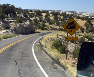 The drive from Torrey to Escalante was beautiful. The 14% grade is a challenge for an RV, but it we took it slow and careful. No problem.
 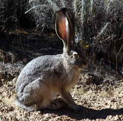 The park Visitor Center was only a few blocks from the campground, so we spent part of the afternoon exploring exhibits and watching the park video. The wall of the center contained a great quote by Terry Tempest Williams:
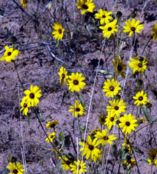 Hole-in-Rock Road
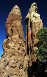
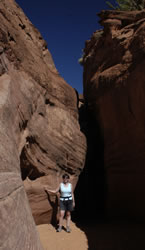
 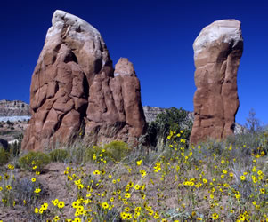 Garden of the Gods
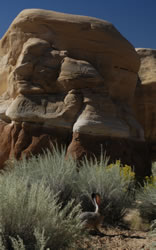
 We spent quite a bit of time crawling around the rocks, tracking the jack rabbits, and enjoying the arches. Although there were a few cars in the parking lot, it was easy to get away from the other visitors.
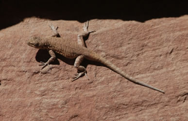
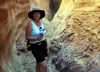
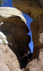
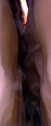
 Peek-a-Boo
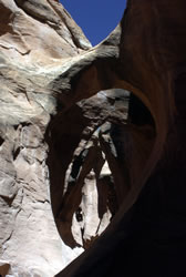
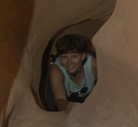 It was fun taking pictures of each other crawling through the arches, tunnels, and slots. We have dozens of hilarious photos of us hanging upside down and sideways. Unfortunately, the sand and dust got on our camera lens, so not all of the photos turned out.
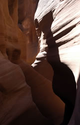
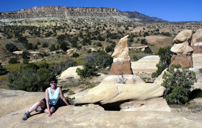
 Around Escalante