Escalante: Calf Creek and Hell's Backbone
We only had time for one long hike, so we chose a trail that promised lots of natural beauty. The guidebooks and websites were right. Grand Staircase-Escalante National Monument is one of the few parks that is administered by the Bureau of Land Management, so you have to pay the BLM fee rather than a NPS fee.
|
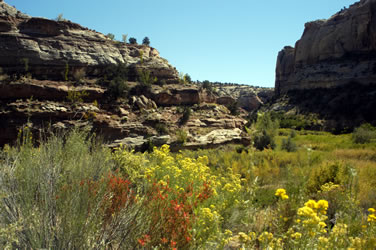
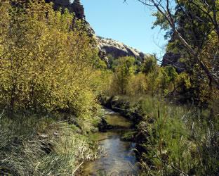
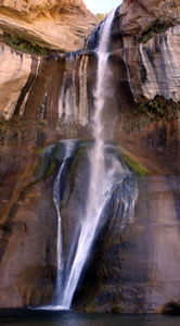
A good parking lot is located next to an excellent, small campground along Calf Creek. The almost six mile Lower Calf Creek Falls hike follows the creek canyon to the Lower Calf Falls. |
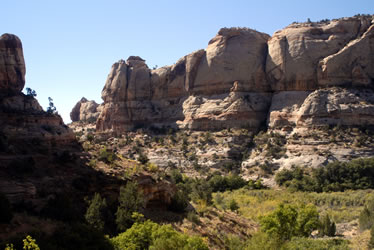
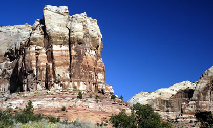
A wonderful view greeted us around every turn.
|
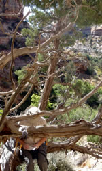
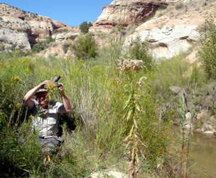
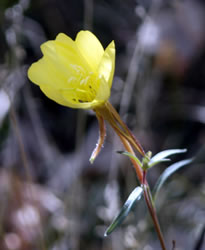
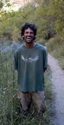 Near the beginning of the trail, we encountered Dave Nessia as we were looking at the fruit on a large patch of prickly pears. An instructor at the Boulder Outdoor Survival School, Dave was several weeks into a planned 40-day personal back-country outdoor challenge and experience. He was living on the land, having hiked in with a small bag of rice, a few cooking spices, and his sleeping bag. Dave was camping in a nearby side canyon cave. He suggested that we join him in a mid-morning snack and try eating some of the bright red prickly pear fruit (avoid the purple for the best flavor and taste). Take care in removing the needles but make sure they are gone. Long used by native people, the fruit normally ripens in late summer and early fall months. We found the pulp inside the leathery skin to be juicy and tart with lots of small seeds. Near the beginning of the trail, we encountered Dave Nessia as we were looking at the fruit on a large patch of prickly pears. An instructor at the Boulder Outdoor Survival School, Dave was several weeks into a planned 40-day personal back-country outdoor challenge and experience. He was living on the land, having hiked in with a small bag of rice, a few cooking spices, and his sleeping bag. Dave was camping in a nearby side canyon cave. He suggested that we join him in a mid-morning snack and try eating some of the bright red prickly pear fruit (avoid the purple for the best flavor and taste). Take care in removing the needles but make sure they are gone. Long used by native people, the fruit normally ripens in late summer and early fall months. We found the pulp inside the leathery skin to be juicy and tart with lots of small seeds. |
  |
|
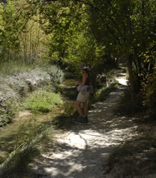
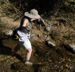
We headed across a grassy area and took off our shoes before crossing the creek. We climbed a sandy slope, then put our shoes back on before proceeding to the ruins.
|
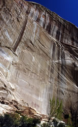
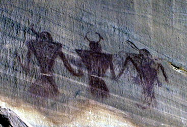
| The best Fremont rock art images were about 20 feet up the cliff near what may have been an entrance to the cliff dwellings. The images were bright red against the white Navajo Sandstone wall. Other images were also found along the wall along with rocks and evidence of ruins. |
|
 We enjoyed the views and found a nice, shaded place to sit and sketch for a while. After walking along the wall where we found other rock art, we headed back across the creek and found the main trail. We were glad that we took the time to make this side-excursion off of the main trail. We enjoyed the views and found a nice, shaded place to sit and sketch for a while. After walking along the wall where we found other rock art, we headed back across the creek and found the main trail. We were glad that we took the time to make this side-excursion off of the main trail. |
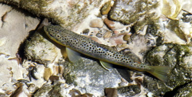
As we got close to the falls, we enjoyed watching the numerous rainbow and brown trout in the creek.
|
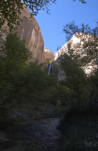
We spent lots of time enjoying the beautiful falls. Larry talked to some other hikers, while Annette sketched the falls. A cool breeze blew moist air across the alcove. There were lots of great rocks and logs for comfortable seating. It was a perfect place for an afternoon picnic of apples, nuts, and water. We reflected on the many people who had visited this area over the past thousand years. We also marveled in the fact that the modern highway 12 is located about one thousand feet above and out-of-sight and sound from the falls; this natural site is isolated from the road by a difficult and seldom climbed gradient. You would not know the highway is there unless you read about it or examined detailed maps carefully; the easiest way in to the falls is the 2.75 mile hike up the creek the way we came in.
|
|
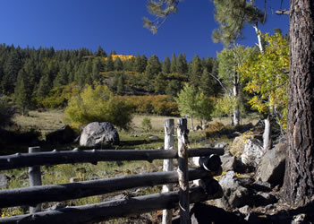
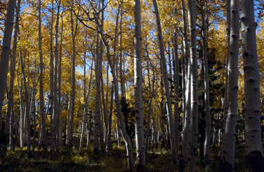
Rather than heading directly back to Escalante, we turned north on Highway 12 toward Boulder. We turned onto Hells Backbone Road (153) west back toward Escalante. The mix of green conifers and golden Aspens was a wonderful combination. |
 |
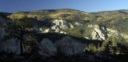
We took a sideroad up a gravel road and enjoyed open pastures and mountain views. There were many areas where we could dry camp with our motorhome. |
The road crosses the "backbone" on a high narrow bridge. The views in both directions are spectacular. We also passed the remains of an old CCC camp before heading home. |
 |
Next Time We could spend months exploring this area. Next time we want to explore the Cannonville area. There's a nice looking KOA campground there that we might use for that stay. This would also give us a chance to again explore Bryce. We'd also like to stay at the Red Canyon USFS Campground. It would be fun to bike through Red Canyon. |
Go to Lamb & Johnson Menu
|
 Since we wanted to complete a loop drive after this hike, we decided increase our pace on the the return trip back to the parking lot and our Jeep. We were surprised how quickly we made it back to the car.
 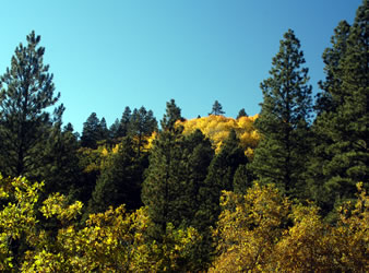 Hell's Backbone