Bighorn Country Day 1, Wyoming After spending a mid-summer month in Casper, we took a short drive up Interstate 25 to spend a week at the base of the Bighorn Mountains in Buffalo, Wyoming. We stationed ourselves at a nice little park called Indian Campground. Although it was under trees, the park had a wireless Internet system so we didn't need to worry about our satellite. |
Bighorn Scenic Byway Because we only had a week scheduled in the area, we decided to go on an overnight trip into the Bighorn National Forest along the Bighorn Scenic Byway. We drove north to Sheridan and started west across Highway 14 toward Burgess Junction. As we traveled up the mountain, we looked back east over the plains and could see for many miles.
Along the way we saw a moose in the distance. After taking a short gravel side road to get a bit closer, we found that the moose had disappeared. We were sure that it did not want any two-legged company. |
We haven't had much time to geocache lately, so we decided to do one on this trip. After a hike half way around the lake, the geocache was easy to find.
|
 |
There were lots of birds and ducks on the lake. As we drove down the gravel road to the highway, we saw a doe and her fawn.
Our next stop was a great US Forest Service Visitor Center at Burgess Junction. After exploring a nearby campground, we headed down Highway 14A on the Medicine Wheel Passage.
|
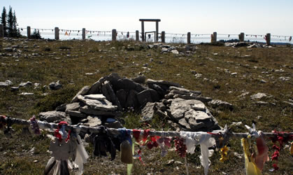
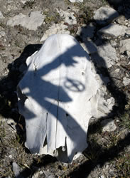
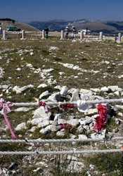
We really enjoyed watching the TNT mini-series Into the West. The medicine wheel featured on the program was a re-creation of the one at this historic site. We stopped at the Medicine Wheel National Historic Landmark parking lot, grabbed some water, and started our 1.5 mile walk on the gravel road up to the site. Although visitors are no longer allowed to drive to the site, we were amazed at the number of cars that had "handicapped stickers" and were allowed to drive rather than walk. With all the dust kicked up from their vehicles driving by, we would have preferred a separate, old-fashioned trail up the mountain rather than the hike along the gravel road. When we reached the top, it was worth the walk. Around 1200 AD, limestone rocks were organized into a medicine wheel 80 feet in diameter. With 28 spokes and 6 small cairns, the medicine wheel has wonderful views in all four directions. This area is still used by many groups for ceremonies.
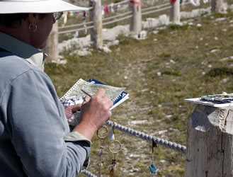
We met an interesting art professor named Peg Speirs from Kutztown University who worked at the site. She was painting watercolor pictures of the site. She was creating watercolors of views from all four directions looking inward, then outward. The photo (below right) shows the artist from across the Medicine Wheel.
|
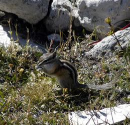
On the walk back, we were treated to a close-up view of a pika working along the rocks near the road. It was fascinating to watch him work his way around the bluff area, gathering grass and taking it back into the rocks.
|
  |
Rockhounding Late in the day we decided to go on a rockhounding adventure in the badlands east of Bighorn Lake. It was hot, but we had a good time hiking around the sandy hills.
|
Camping in the Mountains It was getting late in the afternoon, so we decided to start looking for a camp spot for our tent. We considered staying at the nearly deserted Five Springs Campground (above), but instead decided to go further into the mountains. We took dirt road FH10 off Highway 14A into the mountains. The only person that we saw all evening was a lonely sheep herder eating supper in his small trailer. As it was nearly dusk, when we decided it was time to stop. We chose a wooded area overlooking a wide open area down to the dry Wiley Creek.
Setting up our tent at 10,000 feet, it was dark by the time we had our fire started and made supper. There was not a light for miles and very little noise. The cool weather was excellent for sleeping.
|
 |
Go to Lamb & Johnson Menu
|

 Sibley Lake Geocache

 Medicine Wheel National Historic Landmark
 Pika
Pika


