Physical + Virtual Experiences
Computers are no longer just screens and keyboards. There are many ways to access and use information.
- Go to Google.com. Click the sound icon and talk at your computer.
- Go to Google Images. Drag an image into the search box.
 Use both physical and virtual objects in your classroom. From preschool children to adults, rubber ducks serve as a tactile reference point for learning.
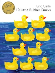
- Read 10 Little Rubber Ducks by Eric Carle. Can you image rubber ducks floating on the open sea?
- Watch String Theory in Two Minutes or Less. The duck was used as a concrete example that viewers could relate to. Buy ducks at Amazon.
- Conduct a "Rubber Duck Debugging" activity. According to Wikipedia,
" The name is a reference to an apocryphal story in which an unnamed expert programmer would keep a rubber duck by his desk at all times, and debug his code by forcing himself to explain it, line-by-line, to the duck.
To use this process, a programmer meticulously explains code to an inanimate object, such as a rubber duck, in the expectation that upon reaching a piece of incorrect code and trying to explain it, the programmer will notice the error."
 Try It!
Use Photo Booth (in your Applications folder) on your iMac to create a short video featuring your duck. Explain something to the duck or have the duck explain something. Or, tell a story using the duck as a prop. It's a great review or problem-solving activity.
Let's explore seven examples of combining physical, virtual, and relevant activities. At the same time, we're asking students to demonstrate critical thinking in selecting, analyzing, and synthesizing information as well as creative thinking applying curiosity, adaptability, flexibility, and fluency to innovate and generate new ideas and products.
GPS, GIS, and Place-based Learning
Get students up and moving. Connect physical, virtual, and relevant activities. Connect globes, satellite images, and relevant topics.
Use databases and quality online resources found at GoWYLD. For instance, SIRS Discoverer has great maps on Madagascar and Greenland that will then lead you to articles.
Watch Google Street View Trekker. Also check out Street View's Gallery.
Begin an exploration of Earth with a guided experience. Earth from Space explores specific locations around the world in five categories: living planet, water & air, structure of land, the human presence, and satellite technology.
Or, explore interactive maps focusing on particular features such as This Dynamic Planet and Mapping Life. Try other resources for data associated with place.
- BetterWorldFlux.
- Data360.
- DebateGraphic.
- Gapminder.
- Public Data Explorer.
- Regional Explorer.
- World Bank Data.
- Worldmapper.
Use Google Maps to create your own placemark, description, and URL to share.
Maps
- National Geographic Mapmaker. Use this interactive tool to generate questions.
- National Geographic Mapmaker 1-Page Maps. This tool allows users to make their own map.
- National Geographic Geo MapMaker Kits. Print out mega-sized maps for tables and walls.
Integrate maps and satellite images into the classroom with website like GoogleLit Trips. Learn more at Let's Go! Google Earth & GIS Resources.
 Try It!
Use Google Maps.
Tell a place-based story involving either fiction or nonfiction elements.
Plan a local history or nature trail. Mark the locations with GPS and find them in Google Maps or Google Earth.

