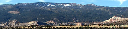
The Natural World:
Explorations
We enjoy exploring the areas around Teasdale. Along with enjoying the scenery, we also like to:
- Walk and Hike
- Photograph and Sketch
- Collect natural objects
- Collect stories and ideas for nature writing
One this page, you'll learn about some great quick trips, half-day trips, and full-day explorations. Also, check out our "to do" list.
Quick Trips
Beas Lewis Flats: Stone Quarry. Driving east out of Torrey, turn right on Beas Lewis Flats road. Proceed through the gate and past the stone quarry. Take a short walk at the dead end.
Bullberry Lakes Road. From Teasdale, take 125 South Street east through the white rocks and back into the foothills. This eventually turns into a 4-wheel drive road. Loop back around into the Donkey Reservoir road. You don't actually get to Bullberry Lake, but you'll see the turnoff.
Burnt Springs. Traveling east out of Lyman on Main Street, you travel a few miles to Burnt Springs.
Canyonlands National Park Road. Driving east out of Torrey, turn right on Canyonlands National Park Road. This is was the old road before the highway and runs parallel to the highway.
Capitol Gorge. Stop at the National Park Visitor Center on Highway 24, then head south along the park road. Take a short hike into Capitol Gorge to see the petroglyphs and pioneer signatures. Also hike to the Tanks.
Capitol Reef Drive. Stop at the National Park Visitor Center on Highway 24, then head south along the park road. Make a stop at the ranch and buildings.
Capitol Reef Petroglyphs. Along Highway 24 in Capitol Reef National Park are a series of petroglyphs on the north side of the road.
Coleman Reservoir. Off Donkey Reservoir road, this is a quick drive leading to a beautiful lake on Boulder Mountain.
Fish Creek Cove. Found off Teasdale - Grover Road, the Fish Creek Cove area is at the base of the Cocks Comb and the location of a small group of petroglyphs.
Fruita Orchards. Along Highway 24 in Capitol Reef National Park you'll find the largest orchards in the national park system.
Goosenecks Point and Sunset Point Trail. In Capitol Reef National Park just west of the visitor center is a one-mile gravel road leading to Gooseneck Point and a 1/3 mile hike out to Sunset Point. A couple nice benches along the trail would be it a great hike for all ages.
Happy Valley. Head south out of Grover on Highway 12. Turn east on Happy Valley road to visit the a small community that's "off the grid".
Hickman Bridge. A popular hike in Capitol Reef National Park will take you to a natural bridge.
Nielsen Grist Mill. Just west of Teasdale on Highway 24 is the Nielsen Grist Mill.
Moki Ruins. Near the east entrance to Capitol Reef National Park you'll find some native ruins and a geocache.
Red Canyon. Ending at the Sunglow Campground, this short drive begins just west of Bicknell.
Sand Creek. When traveling west out of Torrey, take Sand Creek Road north and enter the Fishlake National Forest. Head north toward Sulphur Basin. The road changes from 4-wheel drive to ATV after about a mile and a half. Park at the intersection and walk up the wash for some great petrified wood.
Velvet Ridge Lookout. When traveling west out of Torrey, take Sand Creek Road north and enter the Fishlake National Forest. Stay on the left forks and you'll wind your way up to the overlook. The rest of the road west is designed for ATVs.
Half-Day Tips
Barespot. Traveling east out of Lyman on Main Street, turn north on Horse Valley Road. Take right before you get to Horse Valley and continue up the mountain to Barespot.
Beas Lewis Flats. Driving east out of Torrey, turn right on Beas Lewis Flats road. Take a right at the gate and follow the road as far as you wish.
Bluebell Knoll. At the top of Boulder Mountain, Bluebell Knoll is the highest point on Boulder Mountain. The point is only a few hundred yards north of the road.
Calf Creek. Between Escalante and Boulder, you'll find a wonderful park at Calf Creek. Hike north to the waterfall. If you have time, take the side trail to the petroglyphs.
Capitol Reef Drive to Tantalus Flats. Head south on the Capitol Reef Drive from the National Park Visitor Center on Highway 24. Continue past the end of the road onto the 4-Wheel drive road.
Capitol Reef Drive to Tantalus Flats. Head south on the Capitol Reef Drive from the National Park Visitor Center on Highway 24. Continue past the end of the road onto the South Draw 4-Wheel drive road onto 168, and 186. Past the Bowns Reservoir to Highway 12. Comes past the Rosebud ATV area.
Cedar Mesa and Red Canyon. Take Notom-Bullfrog Road to the Cedar Mesa Campground. Hike out to Red Canyon.
Donkey Point. After passing Bluebell Knoll on Boulder Mountain, we take a short drive to the end of the road near Raft Lake. A beautiful 6-mile round trip hike takes us to Donkey Point.
Donkey Reservoir. At the end of Donkey Reservoir road, you'll find a wonderful, remote spot at the base of the Boulder Mountain cliffs. We saw elk on the rough 4-wheel drive road to this beautiful lake.
Fish Lake Loop. Head west out of Loa and look for the signs to Fish Lake to the north. Take Forest Service Road 640 (Highway 25) around Fish Lake and check out the largest organism in the world, the Aspen grove. This loop intersects with Highway 72 and Loa.
Saddle Pass Road. Located between Bicknell and Lyman, Saddle Pass Road is a wonderful 4-wheel drive road leading into the foothills of Thousand Lakes Mountain. The road winds through Aspen and Pine forests, across washes and pastures. We turn off a side road (east) to a wonderful area overlooking red canyon. The Great Basin Bristlecone Pine trees are beautiful.
Thousand Lakes Mountain. Drive north out of Fremont on Highway 72 and take Forest Road 206 east. Follow the signs to the Elkhorn Campground. Continue on toward Snow Lake (4 miles past the campground). Be sure to take the sideroad to the Deep Creek Desert Overlook for a magnificant view of the Waterpocket Fold. The last few miles gets rough, but it's worth the trip. You'll have great views of Boulder Mountain from Wiff's Pasture. It's about 15 miles from Highway 72 turnoff to the end of the road where it turns into an ATV trail. Enjoy the Engelmann Spruce and Aspens. In the fall, listen for elk bugle.
Full-Day Explorations
Boulder Mountain Loop. Head west on Highway 24 and look for a road on your left past the Mill. This will take you to Posey Lake road, then around by Hells backbone, through Boulder and back around to Teasdale.
Cathedral Valley. Start at the river crossing at the east end of Capitol Reef National Park just off Highway 24. The road runs north then loops around to the east and back south.
Thousand Lakes Loop. Head west out of Teasdale on Highway 24 and north on highway 72 through Fremont. Turn right on Forest Road 206. Take a side-trip to Round Lake and the overlook. Join with the Cathedral Valley Loop at South Desert Spring. You can choose to go right and use the river crossing or turn left and come out at Caineville.
Notom - Burr Trail. Near the east entrance to the park, take Notom Bullfrog Basin road south. This back country road runs along the waterpocket fold. If you have time, stop at the Cedar Mesa campground and hike to the canyon. Stop at the Oyster Shell Reef. Turn on west on Burr Trail road and enjoy the drive to the top. Stop for a picnic at the overlook. If you have time, take a side 4-wheel drive sideroad north and hike to the Strike Valley overlook. Stop in Boulder for dinner, then continue back to Teasdale.
To Do List
This is a list of things we want to do this year.
Beas Lewis. Go the the Y and take the left fork. It may go to Gooseneck overlook.
Bullfrog
Burro Wash and Cottonwood Wash. Take Notom-Bullfrog Road a few miles south, look for pull-offs for hikes along washes and slot canyons.
Caineville Rock Hounding.
Cassidy Arch. Head south on the Capitol Reef Drive from the National Park Visitor Center on Highway 24. Turn left (east) to the parking lot at Echo Cliff.
Cedar Creek. Drive north on Horse Valley Road north of Lyman and take a right before you reach the Horse Valley pasture area. Turn east and stay south of the farm house. The road is currently blocked with an old tree.
Dog Water Creek. Take Notom-Bullfrog Road past Sandy Ranch, go west (left) on Dogwater Creek. Take a short hike.
Fish Creek and Spring Creek. Just south of the Y intersection near Grover-Teasdale and Highway 12 take a right (east).
Fish Lake
Glen Canyon
Golden Throne. Head south on the Capitol Reef Drive from the National Park Visitor Center on Highway 24. Hike to the Golden Throne
Henry Mountains
Long Canyon. From Boulder, head east on Burr Trail road. Hike in canyon.
Lower Muley Twist. Take Notom-Bullfrog Road to Burr Trail. Park in picnic area. Hike south along the ridge.
Miner's Mountain. From Grover, take gravel road to Miner's Mountain.
Pleasant Creek. Take Notom-Bullfrog Road a few miles south, go west (left) on Notom Bench. Hike along Pleasant Creek
Narrows. Drop off a car on the Narrows Trailhead (or the other way around, check elevations) on Highway 24. Head south on the Capitol Reef Drive from the National Park Visitor Center on Highway 24. Turn left (east) to the parking lot at Echo Cliff. Hike the Narrows.
Oak Creek. Take Notom-Bullfrog Road to Sandy Ranch, go west (left) on Oak Creek. Hike part of the way to Lower Bowns Reservoir.
Wolverine Road. From Boulder, head east on Burr Trail road. Then take the Wolverine Road loop.
Sheets Gulch. Take Notom-Bullfrog Road. Before Sandy Ranch, stop at the pull-off on the left (west side) of the road. Hike to Sheets Gulch.
Sulphur Creek Canyon. Take the dirt road just west of the Gooseneck turnoff. Immediately turn right for a quick drive to the canyon.
Lower Muley Twist Area. Hike to Saddle Arch
Thousand Lake Mountain Views. Hike to Flat Top.
White Canyon Flat to Lamp Stand. From Boulder, head east on Burr Trail road. Then take dirt road north.